Space Intelligence’s NbS Project Screening tool delivers screening-grade carbon impact estimates, permanence and leakage risks assessments, and methodology-aligned eligibility checks without the need for expert-level geospatial analyst resources.
Purpose-built for speed and ease of use, it lets you get answers in minutes, store and export results, and move projects through screening faster to scale your NbS program.
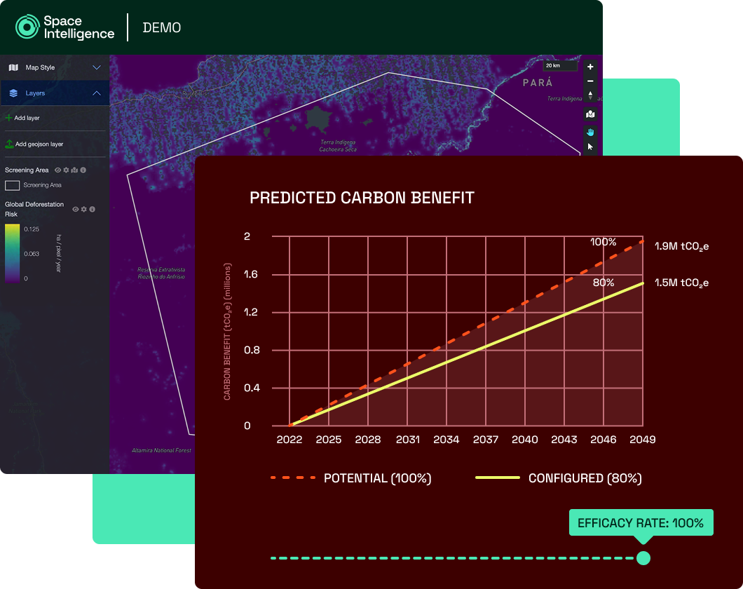
Estimate and model potential carbon impact
Quickly see a project’s potential carbon impact over its lifetime to confirm it qualifies for further diligence.
Model performance by adjusting key inputs specific to your project type, like growth rates, logging plans, and more.
REDD (VM0048)
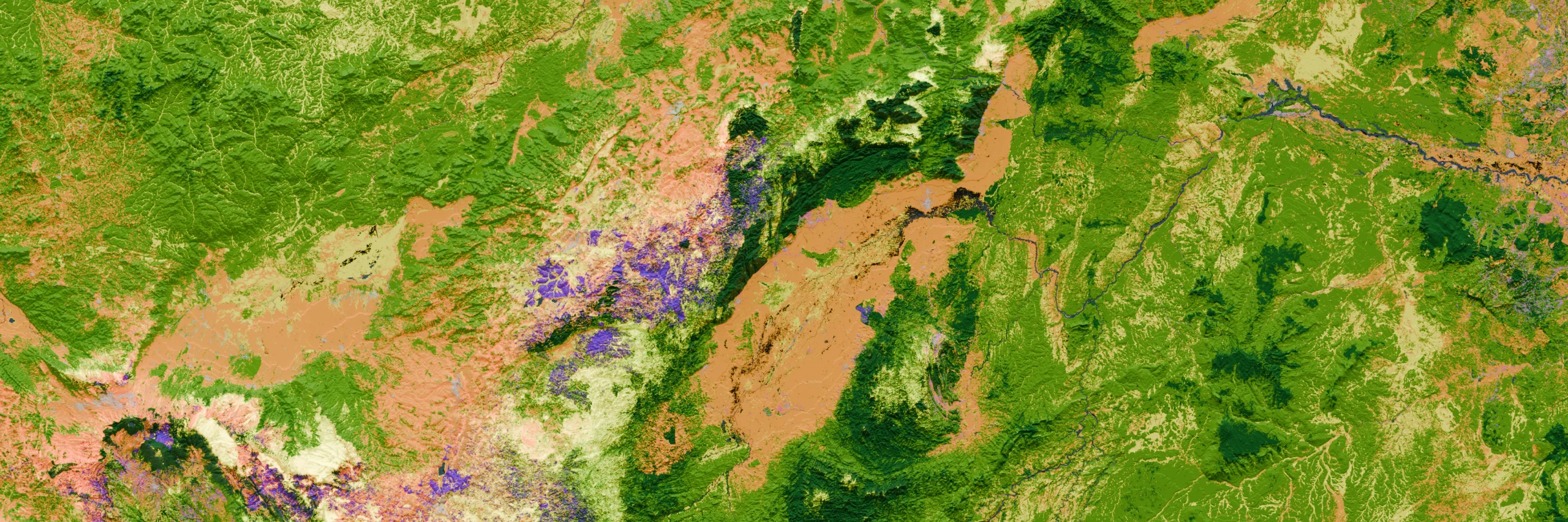
Carbon impact is calculated in line with the risk-based approach of VM0048, incorporating Verra produced baselines where available. Independent deforestation risk maps produced by Space Intelligence are available in select countries to support broader screening.
ARR (VM0047)
The tool automatically suggests the best suited performance benchmark and growth curve based on remote sensing data in the plot location and scientific literature, which you’ll able to adjust.
IFM (VM0010)
The IFM module allows users to assess whether the project area is eligible under Verra’s VM0010 methodology (i.e., the area must be classified as forest), based on present day land cover data.
Assess permanence and leakage risks
Get an automated analysis of potential durability risks that would undermine the project’s long-term integrity, including climate, extreme weather, fire and human-inflicted deforestation.
Leakage Risk
We measure forest-to-agriculture conversion across your project area and a 10km buffer, then bin it low, medium or high. This flags where displacement pressure could undermine the project’s carbon benefit.
Permanence Risk
We model the climate threats to long-term carbon storage: temperature extremes, extreme wind, flooding and sea-level rise. Projections run across 2025, 2035, 2050 and 2075, so you can judge how durable the project’s storage really is.
Fire & Deforestation
We map out fire frequency in the area over the last 5 years, as well as the usual deforestation rate within the AOI and a 10km buffer to estimate potential risk.
Streamline reporting and communication to stakeholders
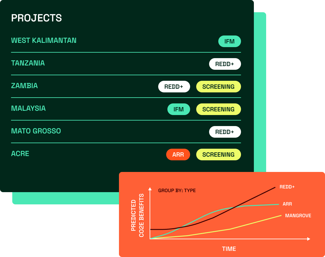
Access, recall, and compare projects in a centralised repository, and easily export project results to share with team members and stakeholders.
Portfolio View
Easily see all screened projects in one place to support access and knowledge-sharing. Aggregate projects to see their total combined carbon impact over a time period.
Project Export
Easily export results as a PDF or CSV to share with stakeholders or use in other due diligence and feasibility models.
Explore NbS Project Screening
Pricing & Plans
NbS Screening Basic
from
£7,000/year
For users looking for a fast, cost-effective review of the basics of a project’s eligibility and carbon potential.
How much does it cost?The NbS Screening tool is licensed on a per-country basis, with screening of all methodologies available within your licensed countries. The yearly subscription includes unlimited users and number of screening projects. Speak to us for pricing based on your needs.
What datasets are used in the tool?To carry out eligibility checks and carbon stock estimations, we use our Global Harmonised Layers dataset: a global coverage dataset that combines the strengths of 18 of the best open-source maps across land cover, above-ground biomass and deforestation layers, enhanced by our mapping expertise.
For production of avoided deforestation under VM0048, we ingest Verra’s provisional allocated deforestation risk maps where available.
What countries are available for screening?Our NbS Project Screening tool is currently available for REDD+ projects with Risk Map availability to allow for the calculation of a baseline.
As of Q1-26 this includes a few states of Brazil (Mato Grosso, Pará, Amazonas, Rondônia), as well as Peru, Zambia, Kenya, Indonesia, Cambodia, Colombia, DRC, Guatemala. Where a Verra baseline is not available, Space Intelligence can produce an independent deforestation risk map to support project impact estimations.
ARR and IFM project screening are available globally.
Request a Personalized Demo
Fill out the form to schedule a demo of NbS Project Screening with one of our product specialists.