EUDR Deforestation - Space Intelligence

EUDR COMPLIANCE

Navigate EUDR Compliance with Confidence

We support deforestation-free supply chains with audit-grade deforestation maps aligned to EUDR requirements.

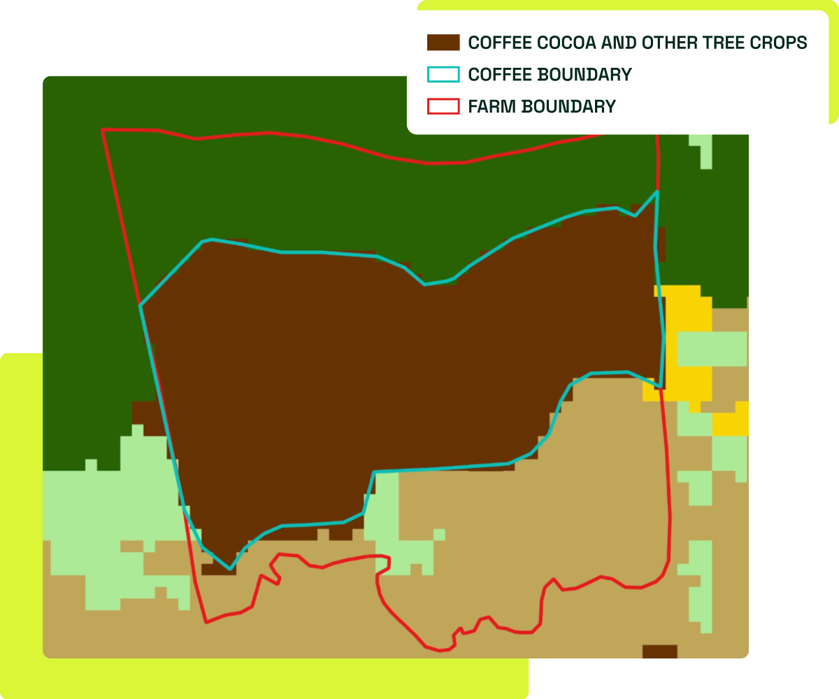
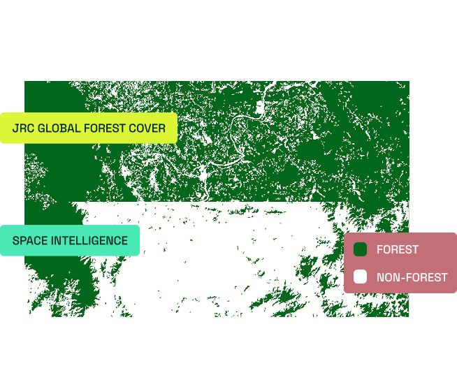
A breach of the EUDR will have significant consequences for commodity wholesalers and their clients, but many geospatial datasets cannot accurately identify shade-grown tree crops, such as cocoa and coffee, compared to forest.

This misclassification puts you and your clients at risk of non-compliance and exclusion from trading into EU supply chains or large fines from EU member states for breaches. This is  why the dataset you rely on to confirm compliance is critical to your business.

We use our deep understanding of remote sensing and forest ecology to overcome these challenges, and create accurate EUDR-aligned deforestation maps that are integrated into the ICE Commodity and Traceability service (CoT) to support sustainable and deforestation-free coffee and cocoa trading within the EU.


Purpose-built Maps for Commodity Detection

Our land cover maps help support commodity traders and operators with their EUDR compliance obligations, and are specifically designed around the requirements of EUDR. We have developed maps covering over 50 countries specifically to meet the EUDR challenge.


Aligned to EUDR forest definition arrow
Our maps focus on the exact cut-off date for EUDR (31st December 2020), and differentiate between tree crops and forest following the EUDR’s forest definition.
10m Resolution arrow
We use 10m x 10m pixel resolution satellite data to track small-scale deforestation on smaller farms and accurately at farm boundaries.
Audit-grade Accuracy arrow
We rigorously assess the uncertainty of our data, ensuring that every map meets our accuracy threshold.

Locally Calibrated with Experts

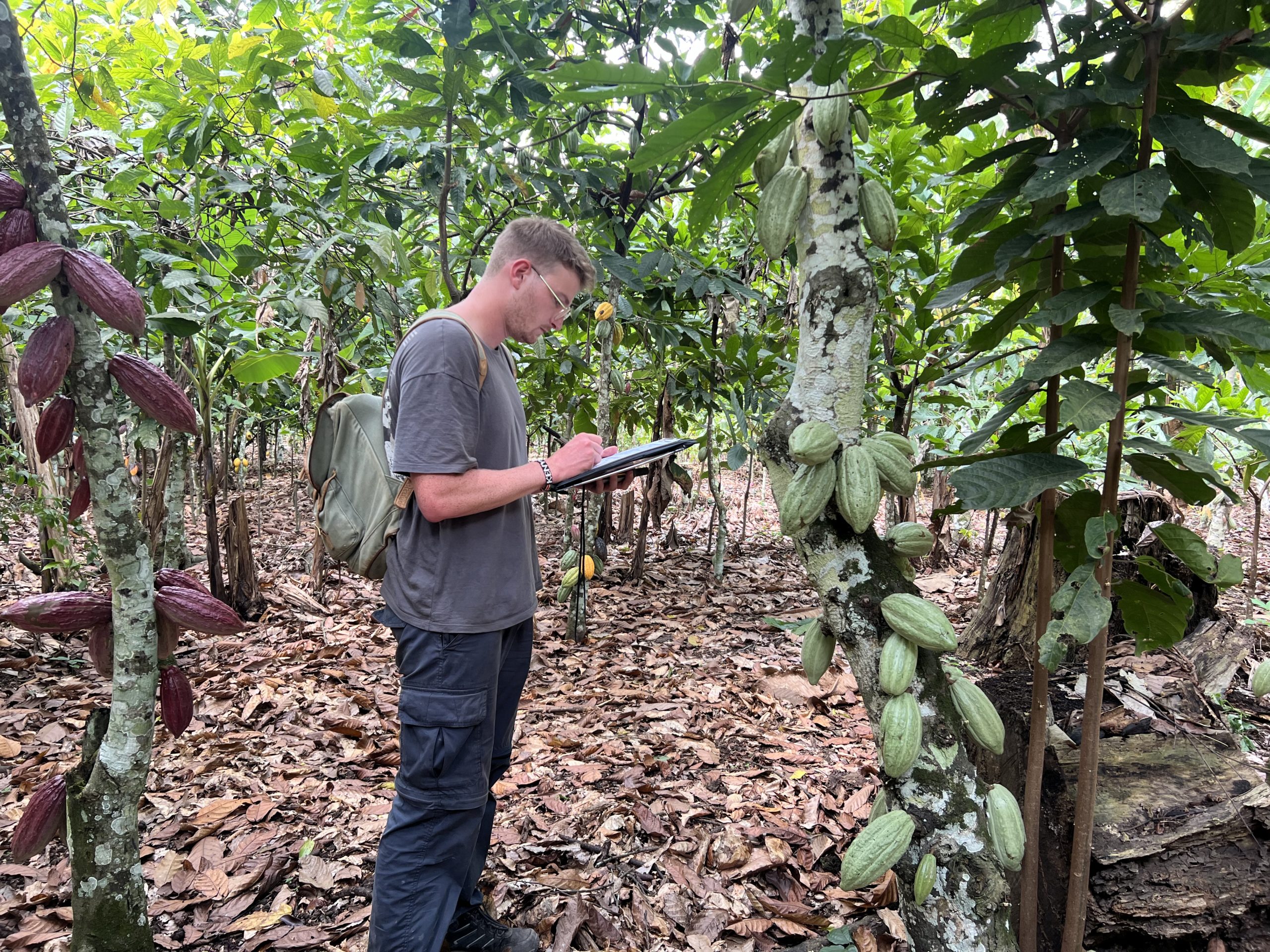
Crops are often planted within, or under, natural forest to protect them from sun or weather conditions, which makes deforestation tracking via remote sensing a challenge. Many datasets classify these shade-grown tree crops as ‘forest’. Compliance with EUDR demands precise, expertly calibrated geospatial insights that accurately reflect the unique climate, ecology, and agricultural practices of each region.


On-the-ground inputs arrow
We use field data we have acquired from the countries being mapped, including from field trips we have completed, as a core input to our mapping process.
Accuracy at scale with machine learning arrow
Our data scientists train and run a machine learning algorithm combining all of our inputs to generate high accuracy maps at country-scale.

Expertly Produced Geospatial Data

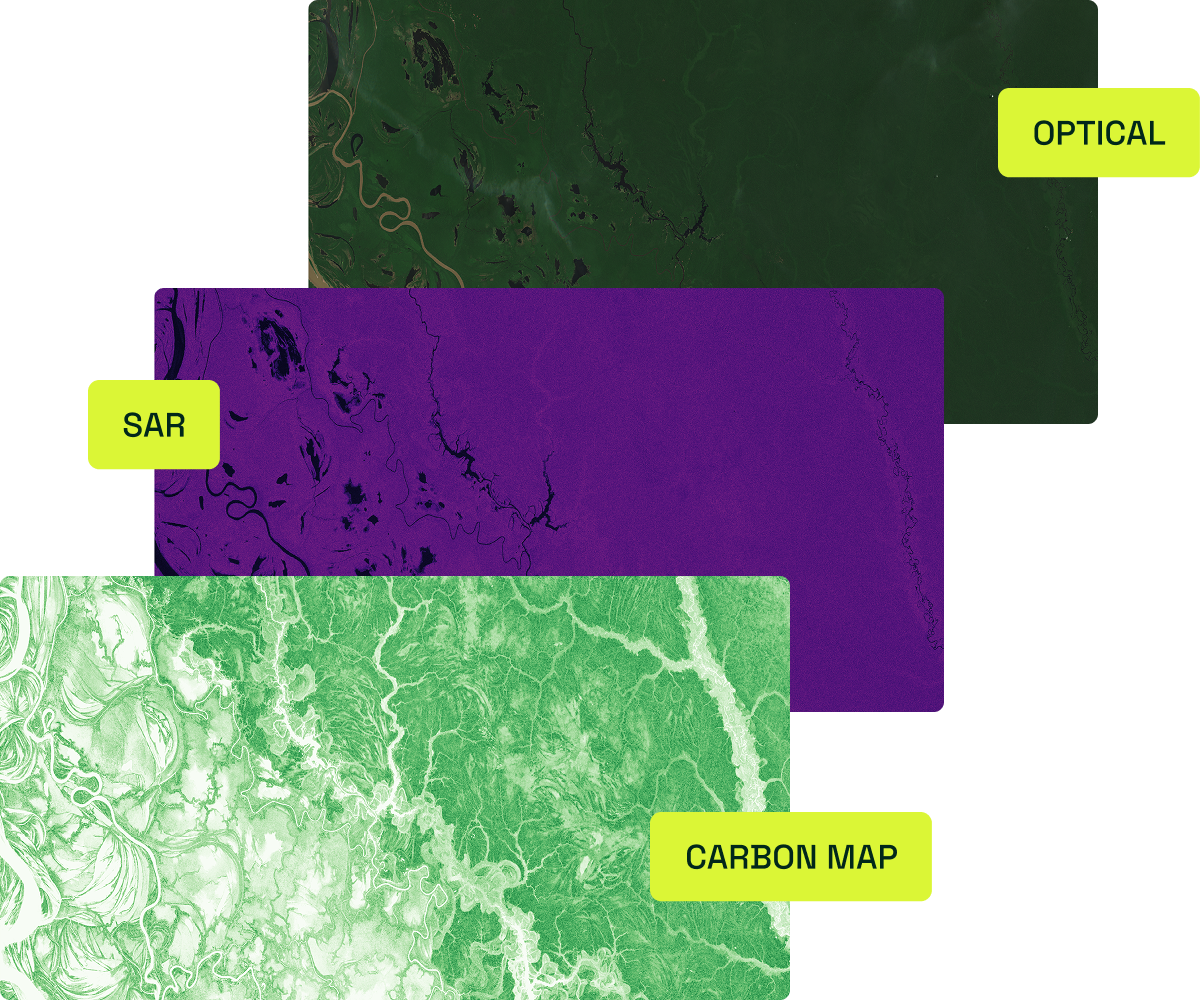
We use hundreds of satellite images of every 10m x 10m pixel, using images throughout the whole calendar year, in order to gather information on how every patch of land changes in different seasons to overcome common challenges in geospatial analysis.

This dense set of diverse satellite datasets enables us to use AI and our expert-collected landcover polygons to produce highly accurate maps.


Optical (i.e. Sentinel-2, Landsats) arrow
Optical satellite sensors use multiple bands throughout the electromagnetic spectrum to help differentiate various types of land cover, and are useful for spotting visual changes in vegetated and non-vegetated surfaces.
Synthetic Aperture Radar (SAR) (i.e. ALOS-2 PALSAR-2) arrow
SAR satellite sensors emit microwave signals that can see through clouds, providing information on the orientation, density and water content of structures on the Earth’s surface (e.g., tree branches and trunks). These are critical to see through canopy gaps and spot the signature of shade-grown coffee bushes and cocoa trees.
Elevation, slope and aspect data arrow
These satellite-derived data help the machine learning algorithms we use correct for certain effects on the data unrelated to land cover.
LiDAR (i.e. GEDI) arrow
LiDAR sensors provide information on tree height and canopy cover, useful in determining points that meet or do not meet the EUDR forest definition.
Contact us