
Carbon Standards

EUDR Compliance

to Carbon Markets


We bring trust to the credibility of claims across carbon markets and supply chain sustainability.
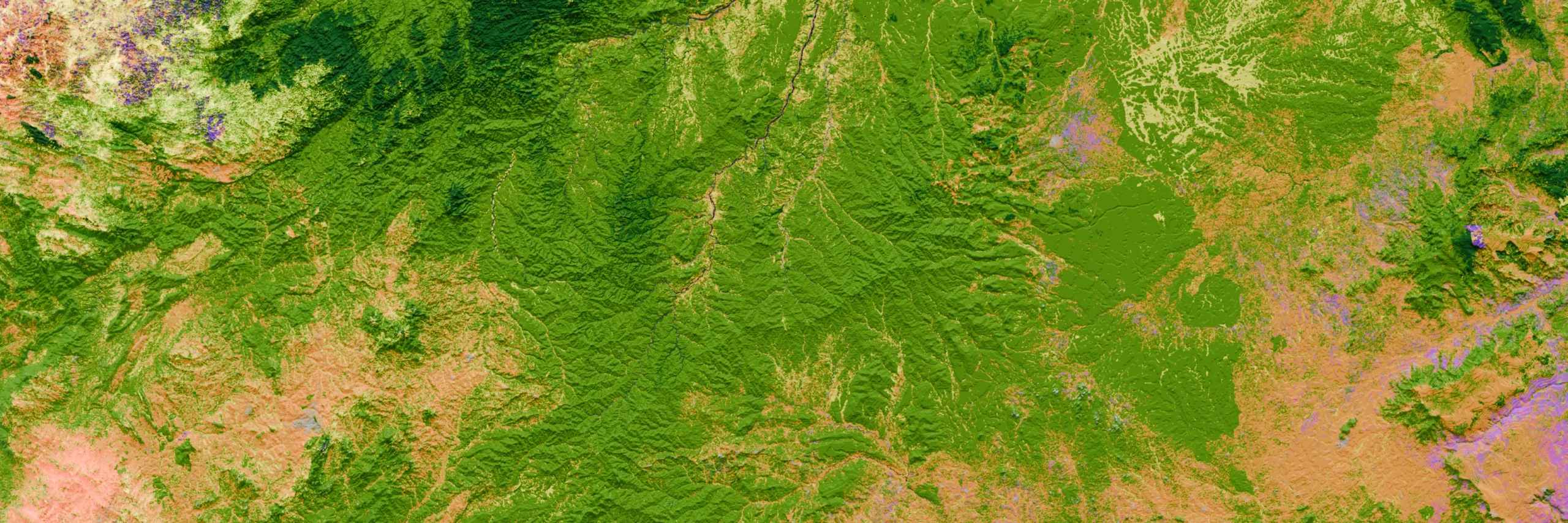
This all begins with our proprietary, audit-grade land cover mapping datasets, developed through decades of on-the-ground and industry experience to deliver results trusted by global markets.

Our data differentiators
Localised calibration
Our mapping catalogue spans more than 50 countries, with each mapping dataset constructed with a localised approach.
While many forest cover datasets use global or contintental-scale models to identify forest cover and change – which can increase errors/uncertainties – each of our datasets is built using input from our ecologist expertise to capture regional factors such as national forest definitions, seasonality of forests, cloud cover impact and more, to produce the most accurate results.

Beyond forest
We take a bottoms-up approach in our mapping, and classify every 10×10 m pixel beyond simple forest/non-forest, capturing mangroves, grasslands, shrubs, and more for more granular carbon sequestration calculations.
This detail supports our clients in understanding the drivers of deforestation and plan NbS project activities.
It also enables accurate mapping of agriculture, plantations, and tree crops, supporting high-integrity carbon project eligibility and EUDR compliance assessments.

Audit- and investment-grade data
Our rigorous accuracy assessment process enables us to deliver and report 90%+ accuracy for forest vs. non-forest mapping.
We meet the strict quality standards of both voluntary and compliance markets. Our datasets have supported multiple NbS verifications under Verra’s VCS, and we supply Activity Data to Verra in support of seven VM0048 REDD jurisdictional baselines.
We’re also the exclusive geospatial mapping partner for ICE’s Commodity Traceability platform, providing high-accuracy forest and commodity mapping required for EUDR compliance.

Providing accuracy at scale
We’re mapping the world’s land cover at audit-grade quality to provide easy access to high accuracy data. We work to a global mapping roadmap, as well as offer bespoke project- or site-level mapping on request.
0
+
Country-Scale
Land Cover Maps
0
+
Land cover Classes
per country
0
+
Minimum Time Points
per Country
0
%
Average Forest/Non-Forest
Accuracy
Accuracy in Action
Discover how Everland used Space Intelligence audit-grade datasets to assess the success of their REDD+ project in Cambodia.