We help you de-risk your NbS program with specialist project analytics tools and services
The integrity bar for NbS keeps rising – your due diligence and monitoring needs to keep pace
Space Intelligence equips investors and credit offtakers with science‑backed portfolio tools and expert services to deliver audit‑grade insights fast, go beyond standards, and de‑risk every project commitment.
Rapid Project Screening
Robust Technical Due Diligence
Portfolio Monitoring
Our Solutions
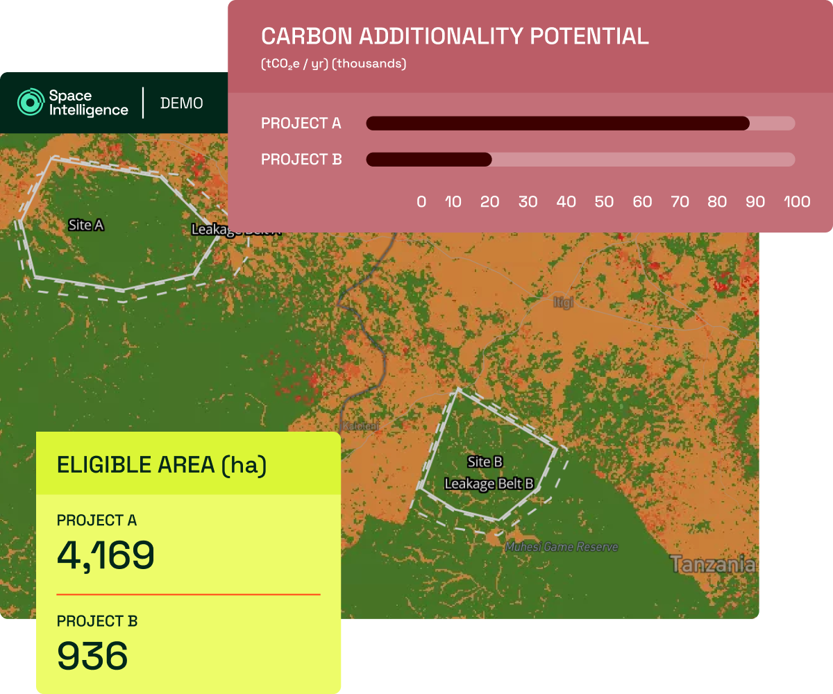
Screen potential projects quickly, confidently
Use our NbS Project Screening tool to quickly assess the eligibility and carbon impact potential of projects against carbon crediting methodologies within minutes to save time and scale your capacity.
- Methodology-aligned eligibility analysis
- Science-backed estimation of carbon impact potential
- Customisable project assumptions
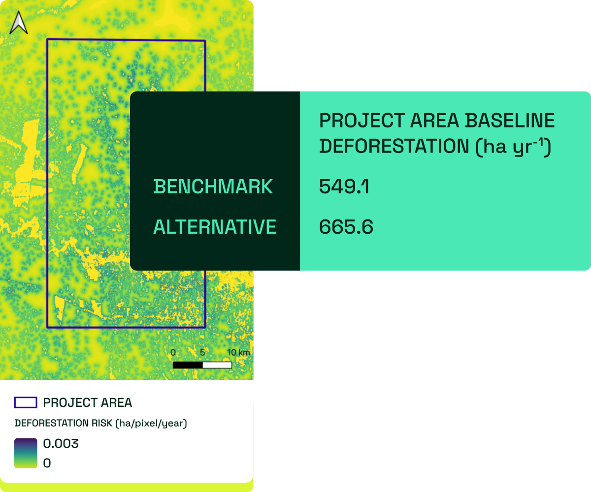
Deep-dive technical Due Diligence services
Gain deeper insights on pre-issuance or operating projects to guide your investment or offtake decisions.
Choose from our standard technical reviews – covering both pre- and post-issuance projects – or request bespoke due diligence tailored to your priorities, all backed by our expertise in geospatial analysis and forest carbon standards.
- Ex-ante estimates of carbon impact
- Ex-post review of credit integrity
- Methodology risk reviews & more
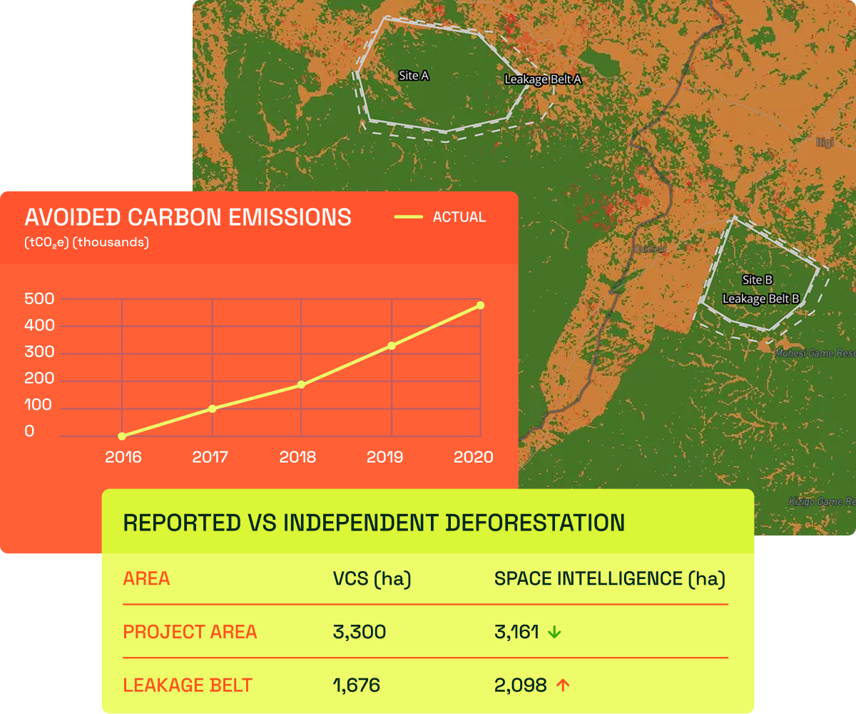
Independent insights on project technical performance
Once invested or your offtake is secured, stay on top of project performance with independent monitoring from Space Intelligence.
-
- Annual impact assessments
- Biodiversity health proxy indicators
- Quarterly degradation and deforestation event monitoring
Why work with Space Intelligence?
Data transparency & consistency
Our core carbon insights and tools are underpinned by our audit-grade geospatial datasets; so you can evaluate projects with consistency and confidence.
Your partner across your program
We can help you navigate the evolving landscape of standards and methodologies with our team of carbon standard experts to go above and beyond just dMRV.
Flexible implementation
Our services are flexible to your needs; whether that is customising the geospatial insights on your projects, or enlisting our support for more out-of-the-box reviews to scale your capacity beyond your existing headcount.
How to work with Space Intelligence
Our packages are flexible to meet your needs. We can conduct one-off reviews of potential or existing projects, or offer a broader bundle of our services to support your program. Contact us to find out more about how we can support your program, whether established or just setting up.