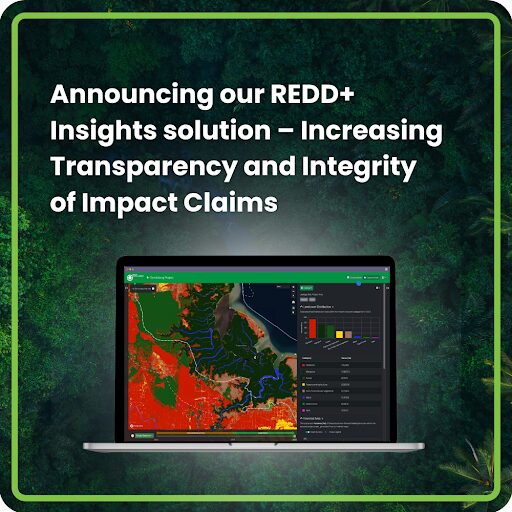
Announcing our REDD+ Insights solution – Increasing Transparency and Integrity of Impact Claims

We believe the voluntary carbon markets can be a powerful mechanism to finance the conservation and restoration of carbon-rich, biodiverse forests – but the last 18 months has shown us that developers, investors, and stakeholders need reliable data on impact to confidently invest and support projects that drive meaningful change.
To address this, I’m delighted to announce the launch of a new web platform designed to provide project developers, buyers, and stakeholders with a clear, data-backed view of NbS project performance. Powered by Space Intelligence’s audit-grade nature mapping data, the platform makes carbon project impact easier to measure, understand, and act upon. Watch the platform in action:
Providing technical insights you can trust
The platform was created to provide an accurate, ongoing assessment of the carbon impact of nature-based solutions projects. It’s designed to translate our high-quality nature mapping data into actionable, accessible insights.
At launch, the platform delivers key functionality for REDD+ projects, including:
- Carbon performance insights: Independent assessments on carbon metrics, including Additionality, Leakage, and Credit Integrity, to enable users to confidently analyse a project’s carbon reduction impact.
- Biodiversity indicators: Metrics on ecosystem connectivity and forest fragmentation give a clear picture of biodiversity health.
- Socio-economic impact integration: The platform allows users to upload socio-economic data, providing a more holistic view of project impact across community metrics such as employment rates and gender equality.
- Early forest disturbance alerts: With our latest tool, DisturbanceTracker, users receive bi-weekly updates on illegal logging, road construction, and other disruptions. This empowers project stakeholders to respond quickly, taking action before there is any significant damage to the project.
Why accuracy matters for the carbon markets
When it comes to assessing the true carbon impact of a project, accuracy is essential. There are many variables that can affect the technical assessment of project performance using geospatial analysis; such as canopy size, seasonality, biodiversity indicators, community involvement, and more. Open-source datasets, while accessible, often lack the precision and granularity required to capture these complexities, and we have repeatedly found that they provide insufficient data to support this work.
Poor quality data can make the difference between a project’s success and failure. This often leads to significant reputational and financial setbacks – not to mention the potential harm to the very forests these projects aim to protect.
Project stakeholders need reliable data and expert analysis to understand and validate real outcomes. That’s why we go through a rigorous process of testing the quality of our maps, with each country mapped having its own independent accuracy assessment conducted by our team of ecologists. Our independent, high-accuracy analysis offers a solid foundation for confidently tracking progress, ensuring that high-integrity projects receive support and continue to deliver positive impact.
Raising the bar for project monitoring
Beyond REDD+ projects, our platform is designed to support broader nature-based solutions goals. In the coming months, we’ll be expanding the platform to include support for insights across ARR projects, enabling users to monitor and manage projects throughout their entire lifecycle.
See REDD+ Insights Solutions in action
Take your own tour around the platform now with our Tanzania REDD+ project sample.

