Purpose-built Maps for Commodity Detection
Our land cover maps help support commodity traders and operators with their EUDR compliance obligations, and are specifically designed around the requirements of EUDR. We have developed maps covering over 50 countries specifically to meet the EUDR challenge.
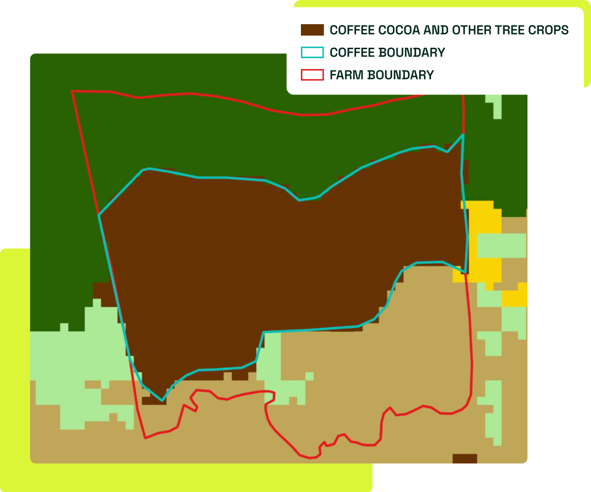
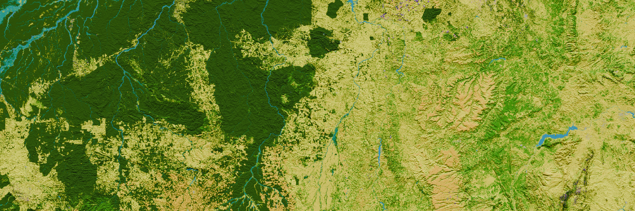
Aligned to EUDR forest definition

Our maps focus on the exact cut-off date for EUDR (31st December 2020), and differentiate between tree crops and forest following the EUDR’s forest definition.
10m Resolution
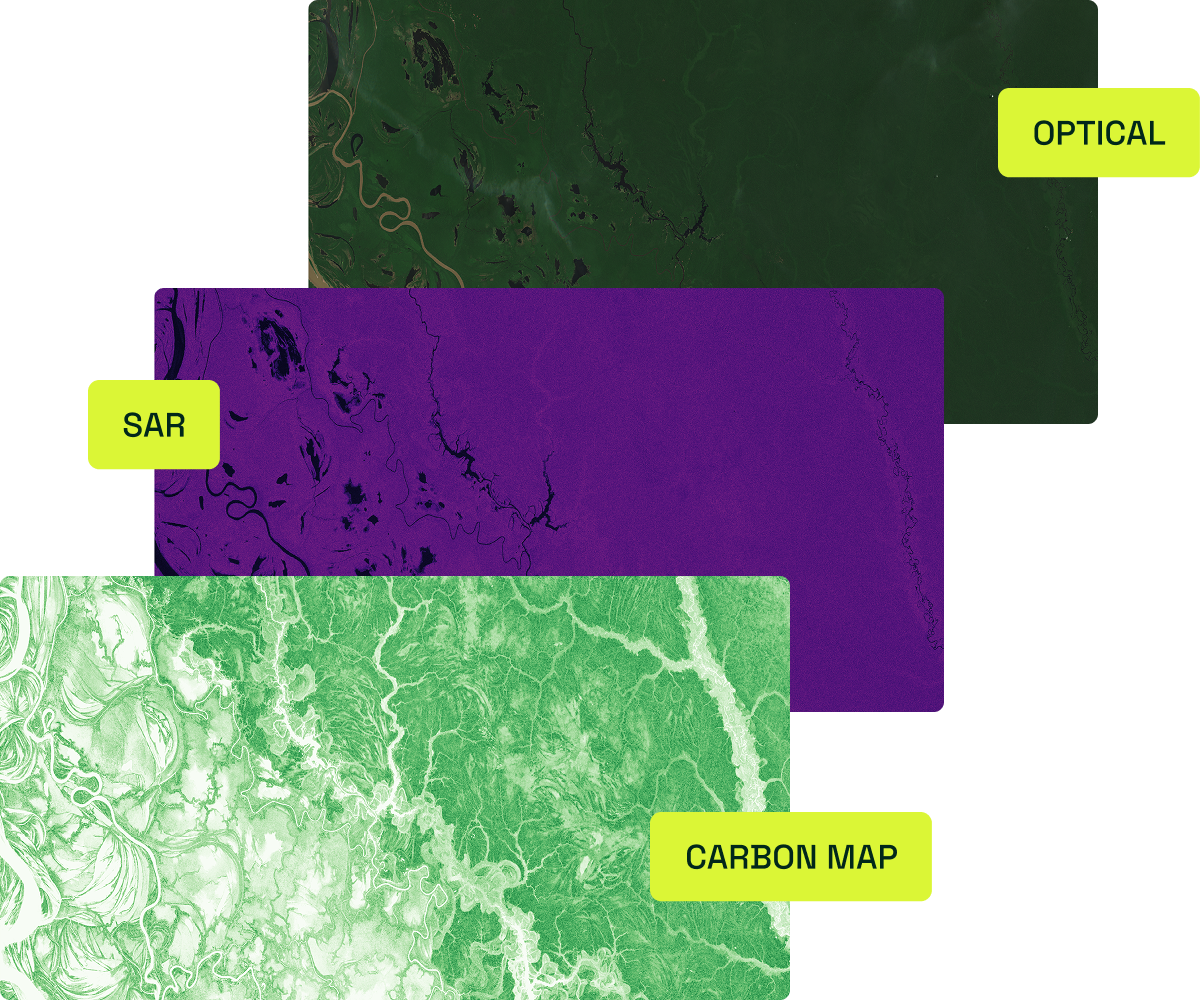
We use 10m x 10m pixel resolution satellite data to track small-scale deforestation on smaller farms and accurately at farm boundaries.
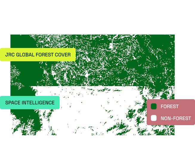
Audit-grade Accuracy
We rigorously assess the uncertainty of our data, ensuring that every map meets our accuracy threshold.