
audit standards

Calibration

Uncertainties
Producing robust quantification of the above-ground biomass of the world’s forests for avoidance and removal projects using geospatial data analysis is achievable – but is highly nuanced. Results can be skewed by any number of factors: seasonality, cloud coverage, different forest types, topographic differences, and much more.
That’s why we believe only a localised approach (versus country- or continental-scale) is suitable for generating the accuracy of per-pixel biomass calculations required to produce audit-grade, defensible claims on the impact of carbon emissions avoidance and removal projects.
We balance scale with accuracy for our clients – ensuring robust estimates and models that meet the rigorous requirements of carbon credit issuance verification and audit through our proprietary process, CarbonMapperTM.
Our methodology
Field data input
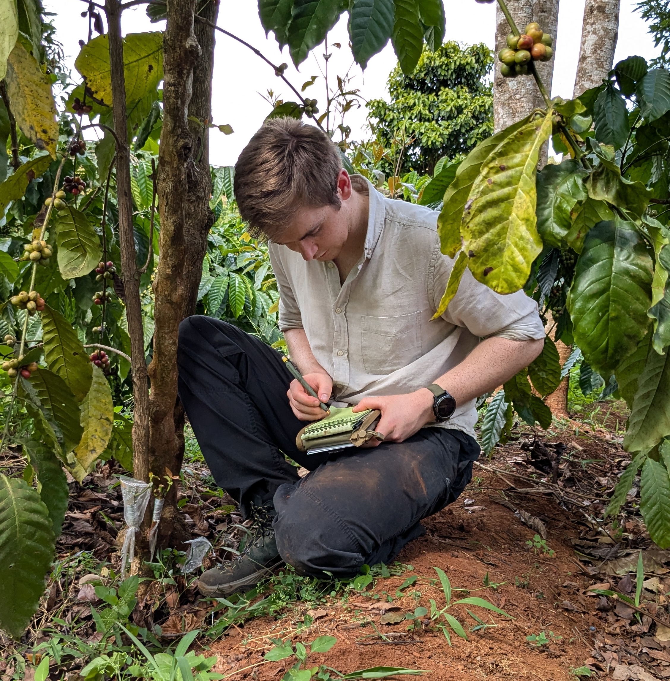
We recommend the use of field plot data, where available, as a key input to the creation of our Above-ground Biomass maps, to establish significant statistical relationships between our remote sensing metrics (e.g., canopy height) and actual biomass values.
We also use field data to independently evaluate the accuracy of our modelled biomass estimates. We have teams of experts across remote sensing science and tropical forests field ecology, and can provide you with recommended field plot data collection protocols, to ensure your collection supports the output of robust data.
Geospatial mapping
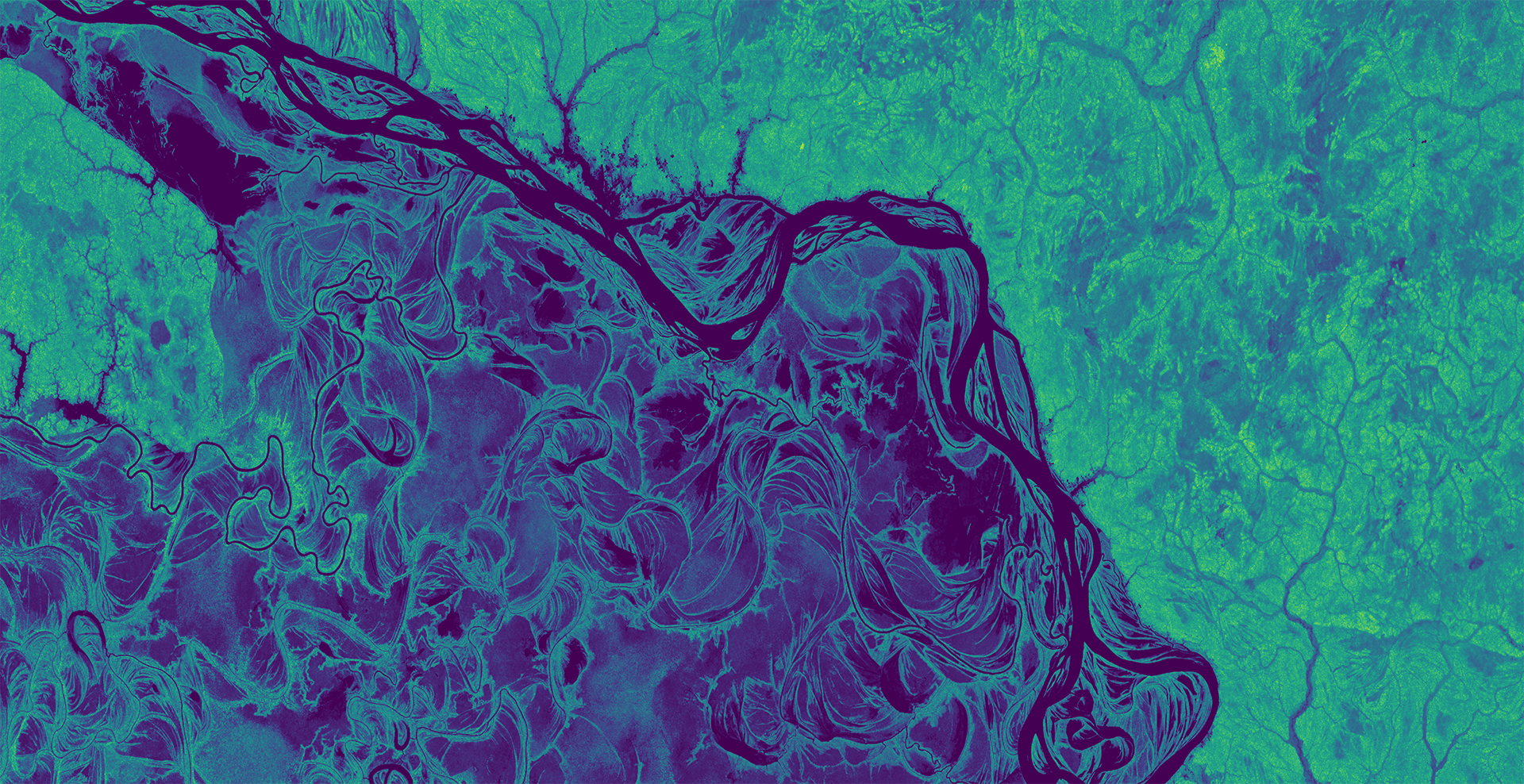
CarbonMapperTM first generates a canopy height map using peer-reviewed methods (Collins et al 2015, Mitchard et al 2012) developed further by Space Intelligence. Canopy height is then converted to biomass using a locally-calibrated allometric model.
We use data from multiple satellites in our technology stack to overcome the challenges of various satellite data types and provide the most robust results.
- Optical data from Landsat-5/7/8/9 and Copernicus/ESA Sentinel-2
- Synthetic Aperture Radar data from Copernicus/ESA Sentinel-1 and JAXA’s ALOS-1 PALSAR-1 and ALOS-2 PALSAR-2
- Spaceborne LiDAR from NASA GEDI and NASA ICESat-2
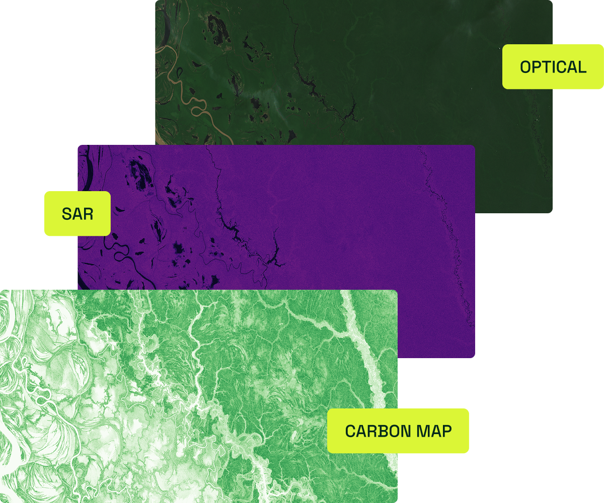
Output
Our above-ground biomass maps are incorporated into a number of our products and services for the voluntary carbon markets, including in supporting project verification and credit issuance, and for use in high integrity reporting of project impact and claims.
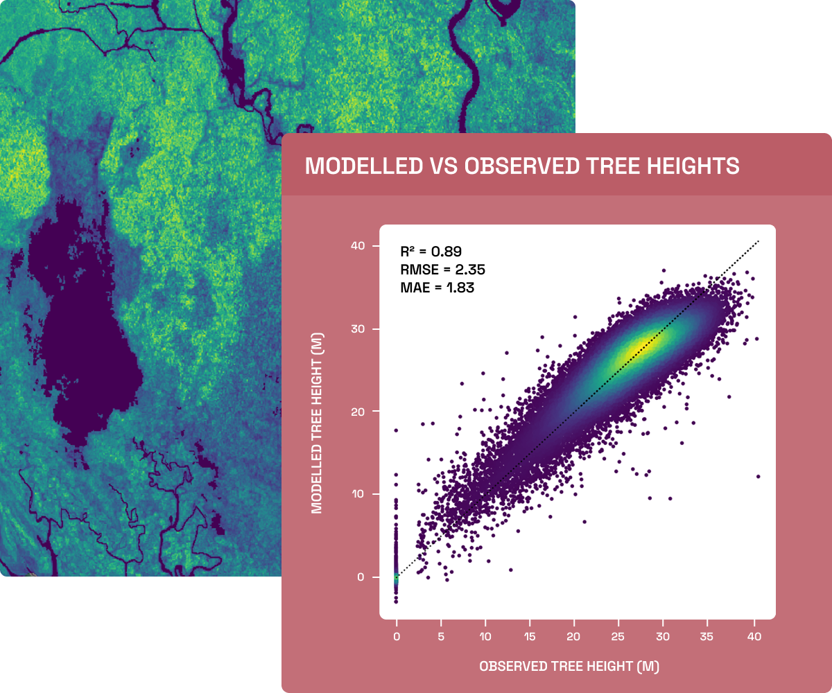
We assess model performance (modelled vs observed canopy height) and provide an uncertainty estimate (95% confidence interval) derived from uncertainty in the height model and allometric equations.
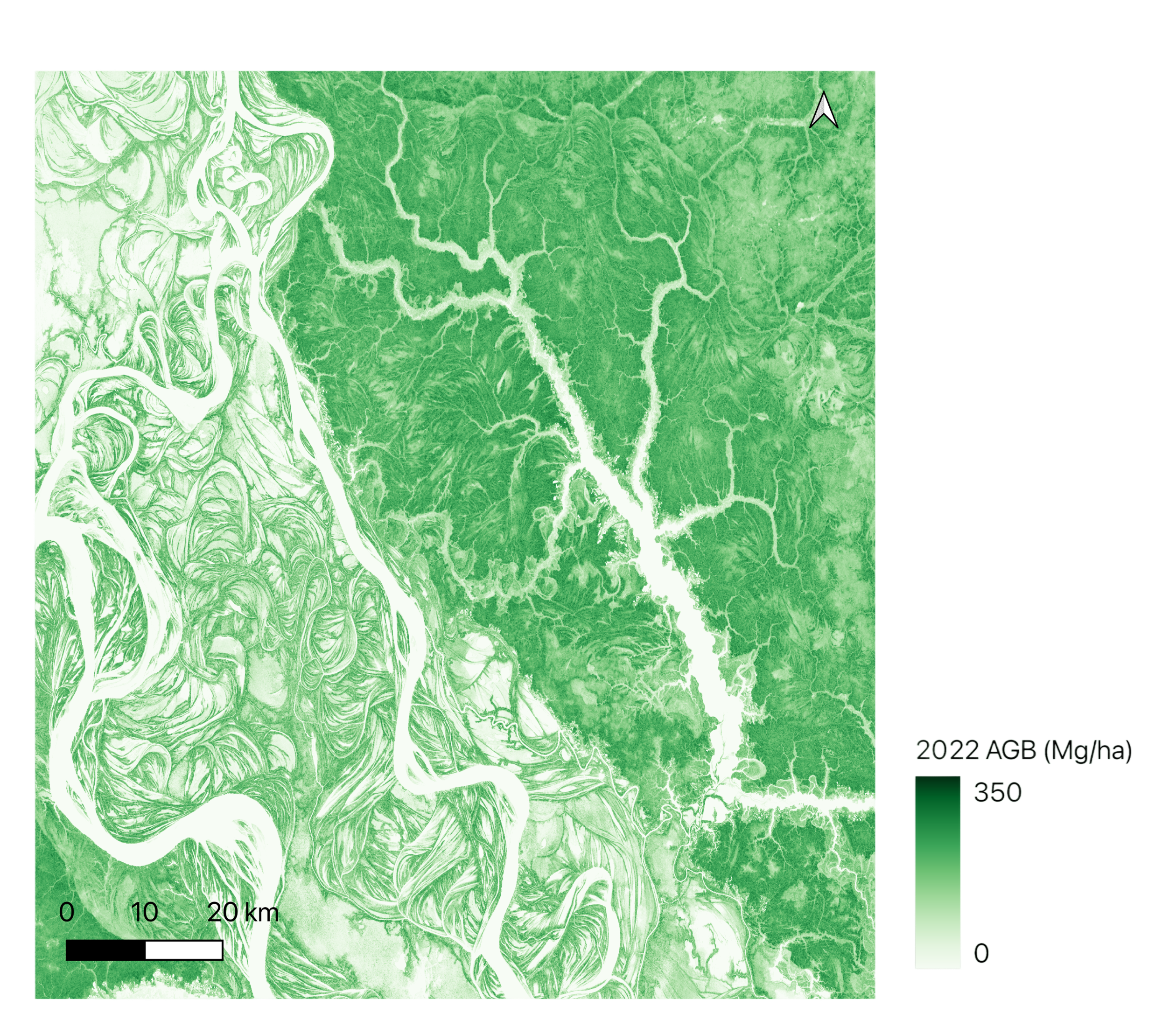
Above-ground data in practice
Our client, a project developer, needed to calculate above-ground biomass for 2021-2022 in >10 discrete areas of interest across a combined area of more than 300,000 hectares in Southeast Asia.
The output of the data was to be used in support of a baseline audit, which required highly accurate results to ensure accurate carbon credit issuance.
They had access and resources to gather field plot data for a more traditional approach to estimating biomass, but understood that extrapolating plots across a region of this size would not give the level of accuracy needed.
We produced above-ground biomass estimates for the full area at a 95% confidence interval. Our work included ingesting client’s collected field plot data to calibrate and validate our remote sensing and machine learning models.
Explore more of our data products & services
We provide a full suite of data products & services to support your entire project lifecycle, from screening all the way through to ongoing monitoring and auditing.