Brazil Map Completed: Announcing Brazil in Full Colour
We’re proud to announce the completion of our national land cover maps for Brazil – our largest and most ambitious mapping project to date.
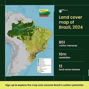
Spanning more than 850 million hectares, our newly released Brazil maps cover 12 land cover classes across 3 time points (2015, 2020 and 2024), offering one of the most detailed, audit-grade views of nature and land use across the country.
To celebrate the release – and to explore the data it presents – we’re launching Brazil in Full Colour, a week-long digital campaign starting June 30.
How We Mapped Brazil

Brazil is the largest national map we have done to date. It covers just under a third of our total mapped catalogue (which includes over 50 countries!).
Over 20 team members contributed across data and mapping science, engineering, operations and ecology. It took months of hard work, iteration, and cross-functional collaboration.
The end result – the map with 94% accuracy for forest, is the culmination of our best tested methods and processes we’ve developed over the past year. We’re incredibly proud of the care, rigour, and ambition that went into this map – and even more excited about what it enables for the voluntary and compliance carbon markets.
Why Brazil in Full Colour?
Brazil is one of the most ecodiverse countries on Earth, home to 60% of the Amazon rainforest, often called the lungs of the planet. With over 60% of its land covered in forest, Brazil holds immense potential for nature-based carbon solutions.
Much of the conversation around Brazil rightly focuses on deforestation – in the Amazon, the Atlantic Forest, and beyond. But while loss deserves urgent attention, we believe the conversation must also shift toward opportunity: the places where we can actively drive impact through both avoided deforestation (planned and unplanned) and large-scale restoration. Both are essential – and both must be used in full measure if we are to truly reverse global forest loss.
Brazil in Full Colour is our way of bringing this opportunity into focus and spotlighting where nature-based carbon solutions can do the most good, grounded in audit-grade data and connected to the work already happening on the ground.
What to Expect

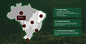
Each day of the event, we’ll release a new Ecoregion Report, taking you inside a different Brazilian biome with a focus on its carbon potential and restoration needs. By signing up, you’ll find:
- Areas eligible for ARR or REDD+ projects
- Estimated carbon sequestration potential
- Forest loss and recovery patterns
- Deforestation dynamics and restoration momentum
- Biodiversity profiles and native ecosystem value
- On-the-ground project highlights and opportunities
We’ve designed the campaign to be useful for project developers, investors, NGOs, and anyone working in forest protection or restoration in Brazil to help you act with greater clarity and confidence.
Get Early Access to Brazil Datasets
Already developing or investing in a carbon project in Brazil? Our new audit-grade land cover data for Brazil is built to support every stage of your project – from early area screening and pre-feasibility assessments to long-term monitoring and reporting.
Tell us what you need, and we’ll show you how our nature data can help assess your project with confidence.
Tag:ARR, brazil, brazil in full colour, land cover, REDD

