With an unwavering commitment to project integrity, Everland undertakes deep technical analysis in due diligence and impact analysis, and needed a nature mapping data partner that could meet their high standards.
We spoke with Everland’s Vice President of Impacts, Will Crosse, and Director of Evaluation & Research, Dr. Maren Pauly, to understand what drove Everland’s decision to partner with Space Intelligence and how it has benefited their work.
A Rigorous Due Diligence Process to Ensure Comprehensive Impact
Everland’s due diligence process is designed to ensure any project they onboard meets their standards of carbon, community, and conservation.
“We only represent projects that are participatory and inclusive of communities in the design, ongoing implementation, and the governance,” Will Crosse explains. “We’re selling a tonne of carbon, but from projects with safeguards in place and additional, measurable, verified community development and biodiversity conservation outcomes.”
In addition to a review of core benefits, Maren explained the process for evaluating a project’s ability to deliver one tonne of carbon for one credit is as thorough.
“In project due diligence, we both identify existing high quality REDD projects and support projects to continuously improve beyond industry standards before we agree to represent them at Everland. That includes a deep technical analysis of many project elements such as performance, additionality and risks. We undertake this through desk-based analyses as well as regular visits to the project and surrounding regions.”

Finding a Nature Mapping Provider that Passed the Threshold
Before partnering with Space Intelligence, Everland used open-source datasets, including Global Forest Watch, to support their due diligence and impact analysis processes.
“We were using open source data sets to investigate historic deforestation of the projects, the leakage, and reference areas, which was really challenging because these data sets aren’t locally calibrated and so they have quite a high likelihood of error. Uncertainty in these datasets is also exacerbated in specific regions,” explained Maren. “These errors are worse in certain regions where we work, like the seasonal forests of Cambodia, the drylands of Kenya, and regions with mangroves. These aren’t accurately mapped by these data sets.”
Matching Quality with Quality
With high standards on impact and a need for reliable geospatial data, Everland actively sought out a better way to analyse project performance and turned to Space Intelligence.
“We really just wanted the highest quality data for our clients to be able to really give them confidence in supporting the REDD+ projects we represent. So that’s what brought us to Space Intelligence.”
Maren and Will explained why the science-backed approach of Space Intelligence drove their decision to partner: “Space Intelligence’s technical expertise is very much rooted in academia. It’s especially important for the work with Everland’s Research function to have a data provider that is backed by academic institutions that’s really active in testing the latest techniques and being very open and transparent about the methodologies, which we don’t always find with other data providers.”

Assessing the Impact of Keo Seima Wildlife Sanctuary REDD+ Project
One of the most powerful outcomes the Everland team has gained from the partnership with Space Intelligence so far was when quantifying the impact of the Keo Seima Wildlife Sanctuary REDD+ Project run by the Royal Government of Cambodia and Wildlife Conservation Society.
Maren explained the importance of accurately mapping the impact of this particular project:
“The Keo Seima Wildlife Sanctuary REDD+ Project is an area of dry seasonal forest within Cambodia. We’ve been on the ground and we’ve seen the absolute destruction of forests around the project. But the open source, uncalibrated data just wasn’t quite showing it. So this was one of the first areas that we asked Space Intelligence to map.”
Once Space Intelligence mapped the area we were able to confirm that the surrounding area has been nearly completely devastated through the conversion of forests to agriculture, plantations and bare land.”

One example Maren shared to evidence this was the Snoul Wildlife Sanctuary, an area next to the Keo Seima Wildlife Sanctuary REDD+ Project.
“The sanctuary had lost nearly 90% of its forests within the last two decades, which led to the de-gazetting of the area – meaning it lost its protected status. And more generally, we were able to find that there was between 4-6% forest loss per year in the region surrounding Keo Seima compared to the project area itself, which experienced <0.7% forest loss per year.
So, we can see the project is in this area of extreme risk from all sides. You have this deforestation coming in through plantations and agriculture. Yet, the project is kind of a stronghold. It is working and reducing deforestation.”
The Importance of Local Calibration and Accuracy in Remote Sensing
Maren explained the value in understanding, in detail, what was causing this deforestation. “The Hansen (Global Forest Watch) data, where it’s very binary as forest/non forest, just simply can’t pick up this detail because those plantations are often misconstrued as forest cover, especially when they get a little bit more mature through time.
“We were able to specify with the Space Intelligence team exactly which land classes that we wanted them to map based on the local context. They did a really detailed, deep dive to ensure that the models were calibrated to suit those different types of land classes within that environment.
Space Intelligence developed some of the first maps to really show what is driving deforestation within this region. This is a really high quality data set that just completely revolutionised how we view the area. Not only does it help us more robustly check these baselines but it delivers real value for the actual ongoing implementation of the project and the targeting of those project activities.”

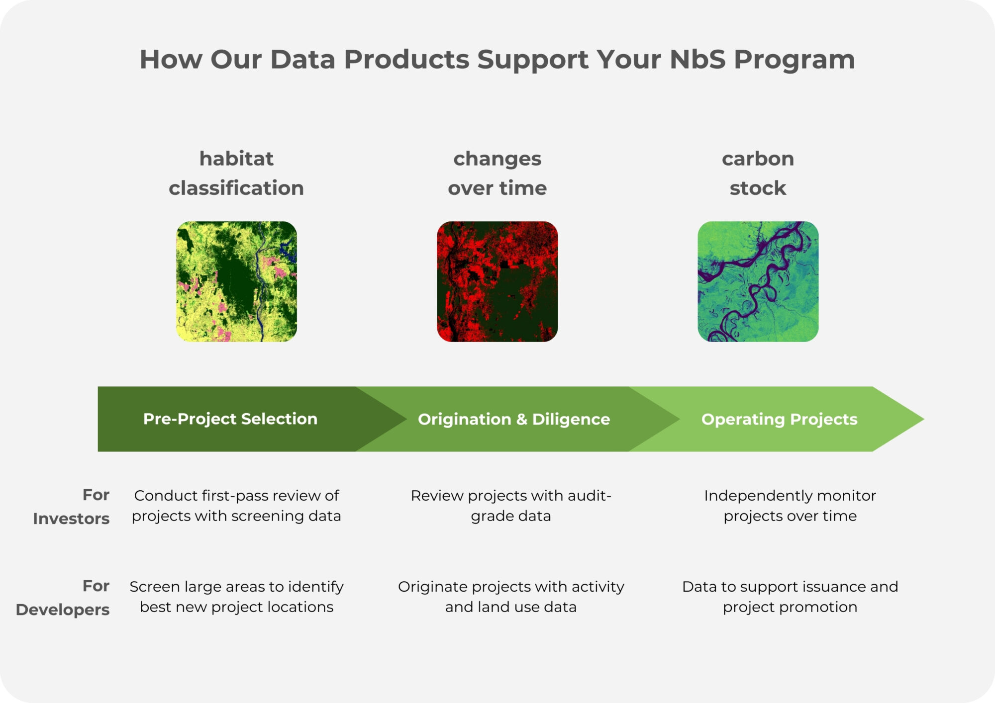
High Accuracy Nature Mapping Data to Support the Full NbS Project Lifecycle
Space Intelligence provides the highest quality nature data insights to support you all phases of forest carbon projects to help you de-risk investment and maximize impact.
We provide you with an independent and highly accurate source of truth on projects that you can have confidence in standing behind.

