Back

For companies who are investing in high-quality nature-based solutions credits, Space Intelligence provides the highest quality nature data to support you through all phases of reviewing and monitoring to de-risk your investment and maximise impact.

Instead of relying on shallow data from project developers, we can provide you with an independent and highly accurate source of truth on projects that you can have confidence in standing behind.

Supporting climate impact through data for the carbon markets ecosystem

Arise Logo
Biodiversity Consultancy Logo
Equinor Logo
Shell GameChanger

Complete your own due diligence on carbon credit quality

Use Space Intelligence to conduct independent analysis of project site baselines to validate assumptions before purchasing credits. 

Get information on changes across forest canopy cover and other landcover classes, and highly accurate maps of above-ground biomass and carbon stock estimates.

Gain full transparency on changes to your portfolio’s carbon tracking

Traditional methods of monitoring forest carbon projects can be costly and time-consuming for developers, meaning you may only get comprehensive nature data every five years. 

With our remote sensing techniques, you can access data every year on full project sites to ensure insight into changes in land cover and carbon stocks and validate a project’s progress against the initial goals.
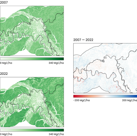
Project dev - Carbon Change Maps, Amazonas WCS (2) (1)

Showcase the impact of your program to all stakeholders. With confidence.

Our team has decades of experience in remote sensing, forest ecology, and geospatial analysis to provide you with robust, science-based data you can stand behind.

This unique combination of expertise has led us to be selected to produce national baseline maps for Verra, and be the trusted partner for projects across South America, Africa, and South-East Asia.
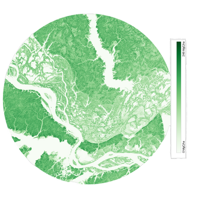
AGB Map Amazon

How It Works

Step 1: You provide details

Whether you’re looking to evaluate and due diligence a potential project, or enhancing monitoring for existing portfolios, provide basic information on a project’s area and any existing field data from the developer.

Step 2: We collect and analyse data

We fuse large amounts of data from a number of satellites and field data using our proprietary technology, developed through over 30 years’ of combined research experience.

Step 3: You get out-of-the-box insights

Whether you need information on forest canopy cover, landcover, carbon or biomass estimates, we deliver the resulting information and analysis in the format you need.

We can produce bespoke reports for truly out-of-the-box insights, create custom online maps for visual interpretation, or supply data files of the output for further analysis by in-house geospatial intelligence teams.

Maximise your offset program’s impact

Space Intelligence is a trusted provider to both sides of the nature-based solutions ecosystem and is on a mission to end deforestation and achieve mass reforestation by providing the data needed to create and support high-quality forest carbon projects.

Enquire now to explore how to vet and validate your nature-based solutions program with Space Intelligence.

Contact Us

Recent News

Nature at New York Climate Week 2024

New York Climate Week is fast approaching and the list of events is even bigger than the 2023 edition, which hosted more than 500 individual events across the week. For the nature-based community, the number …

ICE Collaborates with Space Intelligence to launch ICE’s EUDR verification platform

I’ve spent my whole career trying to create maps that are used to stop and reverse deforestation. This was the main driver behind starting Space Intelligence with my co-founder Murray Collins back in 2018: we …

Space Intelligence raises Series A funding from AzurX Space Ventures, Intercontinental Exchange Inc. (ICE)

Read our press release (here) for full details. We’re excited to announce the close of our Series A funding round, led by AzurX Space Ventures (ASV), a strategic consultancy and investor in space-based technologies, with …

What are the Challenges in Mapping Cambodia’s Forests?

Cambodia hosts a range of forest types including evergreen, semi evergreen, deciduous forests, flooded forests, and mangroves. This is really fantastic from an ecological perspective, but creates challenges in the modelling and the production of …