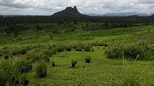
Sierra Leone surveys
We have finished completing surveys in Sierra Leone on a forest mapping project. These data were used to produce a landscape classification map for a large project, and will support conservation and sustainable development.
To do this, our field surveys involved visiting over 100 points across the landscape, and documenting ecological variables including tree families present, tree height, and canopy closure. These data then informed a machine-learning analysis of a series of satellite images, to produce a classified map of the landscape. This map is now being used by our clients to plan a new season of forests surveys.
Get in touch to see how we can help you with forest and landscape mapping and surveying! [email protected]


