As a project developer you create and manage high-integrity forest carbon projects that generate real on-the-ground impact – across carbon, community, and biodiversity.
But with increasing scrutiny from investors and credit buyers, you need to ensure you are making project decisions and claims based on data you and stakeholders can trust.
Our high accuracy nature data + insights provides you with the confidence you need to create, evidence, and protect impact of projects. Audit-grade land cover and deforestation data powers a suite of products to support you across every phase of your project development lifecycle.
CREATE
Maximise your program’s potential from the outset
Ensure you’re only progressing the highest potential impact and eligible projects through your origination pipeline with our pre-feasibility screening reports for ARR and REDD+
We provide you with robust insights into technical feasibility of projects across key criteria:
- Assessment of Project Site Eligibility to Methodology (either VM0048 or VM0047)
- Insights into land cover dynamics to support additionality assessment.
- Review of National + Regional environmental legislation.
- Mapping of roads and rivers to give you quick indicator of challenges or ease of transport logistics of tools and people for project operations.
- Mapping of previous fires in region to help you assess potential risk of fires.
ASSESS
Measure and communicate project impact with confidence
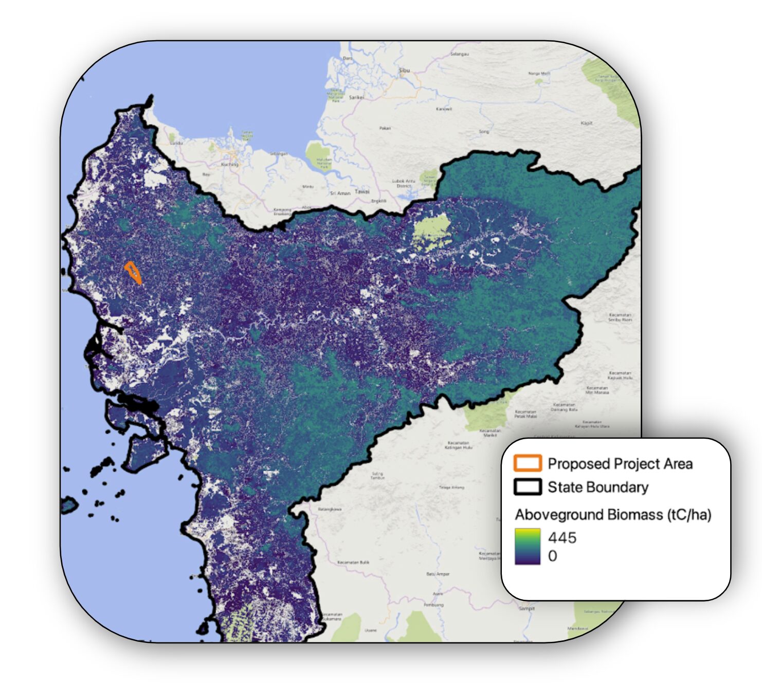
Space Intelligence’s Impact Assessment tool provides project developers with deep technical insights on project impact they can trust.
We do this by using our audit-grade nature mapping data to provide:
- Independent review of project performance across crediting period for additionality, permanence, and leakage.
- A robust credit integrity assessment, using our independent data to estimate the observed emissions avoidance vs. what has been reported by the project.
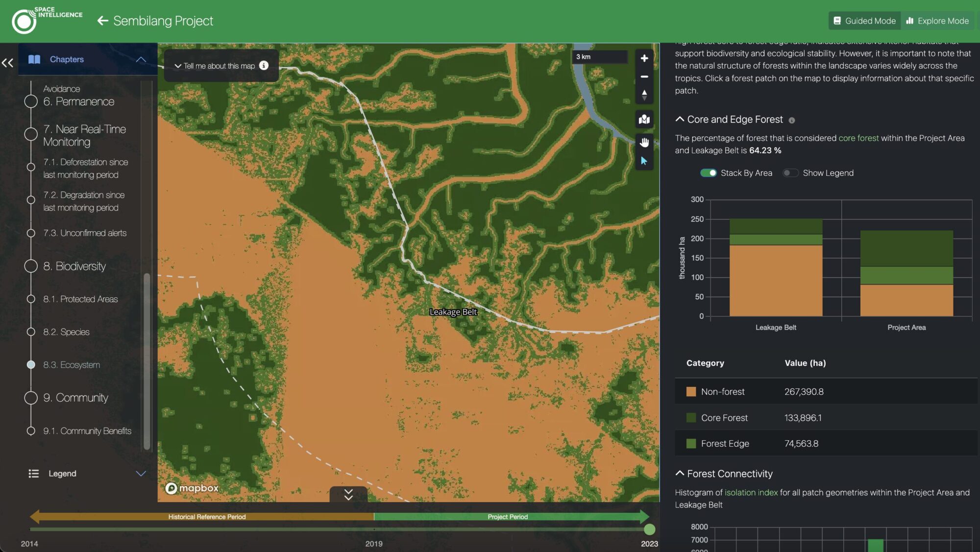
- Access to detailed insights and statistics on land cover change within the project area across a time period to support
- Assessment of biodiversity based on forest connectivity and fragmentation.
PROTECT
Monitor loss risks in near-real time with disturbance insights
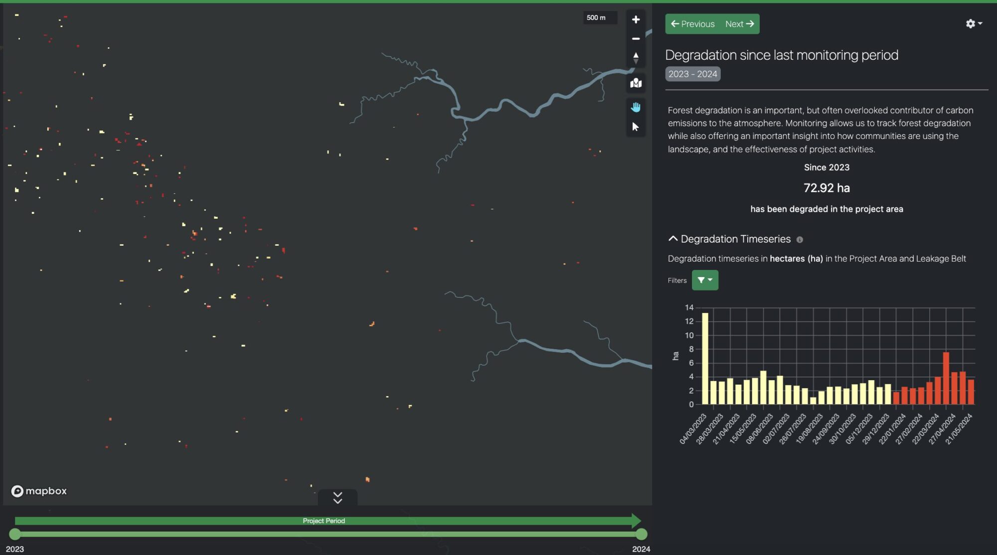
For REDD+ and mature ARR projects, monitor small scale canopy loss that might indicate larger risks and loss. Receive bi-weekly updates of unconfirmed degradation enable you to intervene against further clearance before it’s too late. Quantify confirmed deforestation data every three months to understand impact.
Maximise your project’s impact
Space Intelligence is a trusted provider to both sides of the nature-based solutions ecosystem and is on a mission to end deforestation and achieve mass reforestation by providing the data needed to create and support high-quality forest carbon projects.
Enquire now to explore how to maximise your project’s impact with Space Intelligence.

